
Services
Procurement Services
- Globe valves
- Gate valves
- Check valves
- Ball valves
- Butterfly valves
- Remote controlled valves
- Gaskets
- Fittings
Geophysical Services
Non-seismic Services
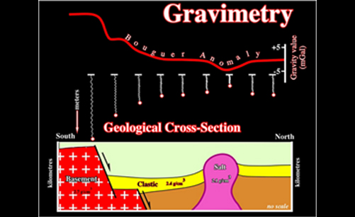
Gravimetry and magnetometry surveys play important role in oil exploration operations because they can recognize structures which represent faults. Faults have considerable impacts on upward movement of oil and gas, formation of hydrocarbon traps and consequently formation of oil and gas reservoirs.
The electrical resistivity method is the most efficient techniques for foundation studies and groundwater Exploration. Information about aquifers, water tables, salinities, impermeable formations, bedrock depths, etc. can be obtained by such surveys; Moreover, electrical resistance survey is one of the methods utilized in archaeological geophysics. In this type of survey, electrical resistance meters are used to detect and map subsurface archaeological features and patterning.
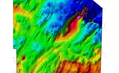
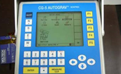
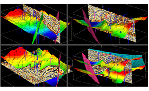
Gravity and magnetic surveys are used in regional and deep exploration, in the prospection of deposits and in engineering and environmental geophysics. These methods are usually performed to cover prospective areas before application of other cost intensive exploration methods. Integrated interpretation of seismic data with high-resolution gravity and magnetic surveys is one of the efficient tools to solve problems in areas with complex geology. For data acquisition, highly sensitive gravimeters (Scintre Autograv CG-3M+/CG-5M, LaCoste & Romberg, Sodin and Sharpe) and magnetometers (proton precession magnetometers, optically pumped vapor magnetometers, fluxgate-gradiometers) as well as state of the art geodetic instruments (electro optical tachymeter, satellite navigation system for real-time GPS) are provided. Magnetic surveys can be performed on-shore, airborne, off-shore or in boreholes. For data processing, modeling and geological interpretation, a variety of software modules are used. All reductions, corrections, field transformations and different inversion techniques as well as 2D and 3D modeling are practically feasible. Based on the certified quality and HSE policy of company, we offer the employment of experienced staff at field crews.
Seismic Services
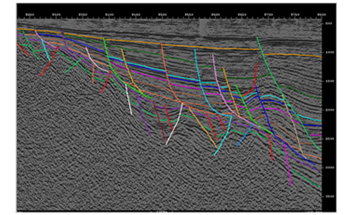
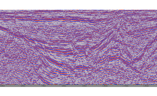
We cover the complete chain of activities starting from seismic designing, acquisition, processing to interpretation and reservoir characterization. We completed several successful projects in this regard and we cooperate with many local and foreign partners. IPS is a well-known company in seismic supervision field for both 2D and 3D seismic projects which uses latest international standards in Quality Control of seismic data and Operation, and also fully qualified international client representatives who have enough experiences in Iran and all over the world.
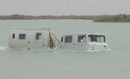
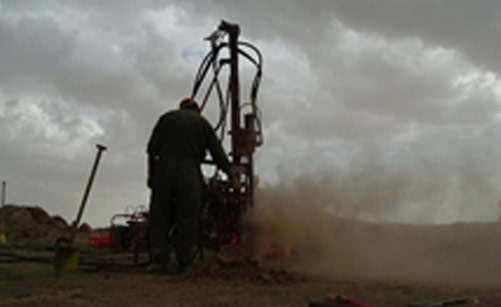
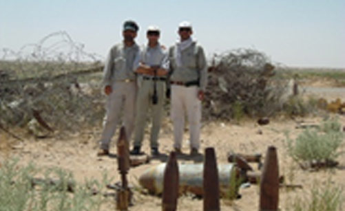
Seismic data acquisition is one of the most important part of the oil and gas exploration .We are able to operate 2D & 3D Seismic Data Acquisition in different type of terrain such as mountains, jungles, deserts, transition zones and marine through using experienced crew and proper equipments. There are five key elements to acquire useful seismic data acquisition:
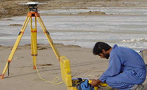
- 1. Positioning / Surveying
- 2. Drilling
- 3. Seismic Energy Source
- 4. Data Recording
- 5. Data onsite Processing

Drilling Services
IPS provides drilling operations management services, experienced consultants and stateoftheart well engineering solutions. IPS is specialized in complex well design drilling, workover and completion engineering.
IPS proposition to the Oil and Gas industry: Well Engineering Drilling Operations Management and Directional drilling Rig Analysis, Cementing, Coring ,Casing ,Mud logging ,Tubing Services Supply of all draw works parts, Bits, B O P, Well head, Coring equipments, Piping material, Casing, tubing, and H2S Services. Provision of Manpower and Recruiting services. Provision of Surface Facilities Training